Supposedly it is one of the most beautiful one-day hikes in New Zealand and the Tongariro Alpine Crossing can be a true challenge of your inner youth. Imagine someone who lives behind a computer screen, likes the convenience of fast food a little to much and doesn’t walk more then 10 minutes a day… Yes, I am that stereotype.
Since my first visit to New Zealand I knew this would be the perfect base camp for the next 10 years of my travels. Although remotely positioned on the edge of the world it is also conveniently close to some of the most beautiful islands in the world including New Zealand herself. And ever since I got back the Tongariro Alpine Crossing was high on my list.
Ever since I got the opportunity to stare into an erupting volcano in Vanuatu I am fascinated by them. Like fire, you can stare at it for ages, but many times more awesome. I reckon its in line with the other raw powers of the earth like earthquakes and tornadoes.
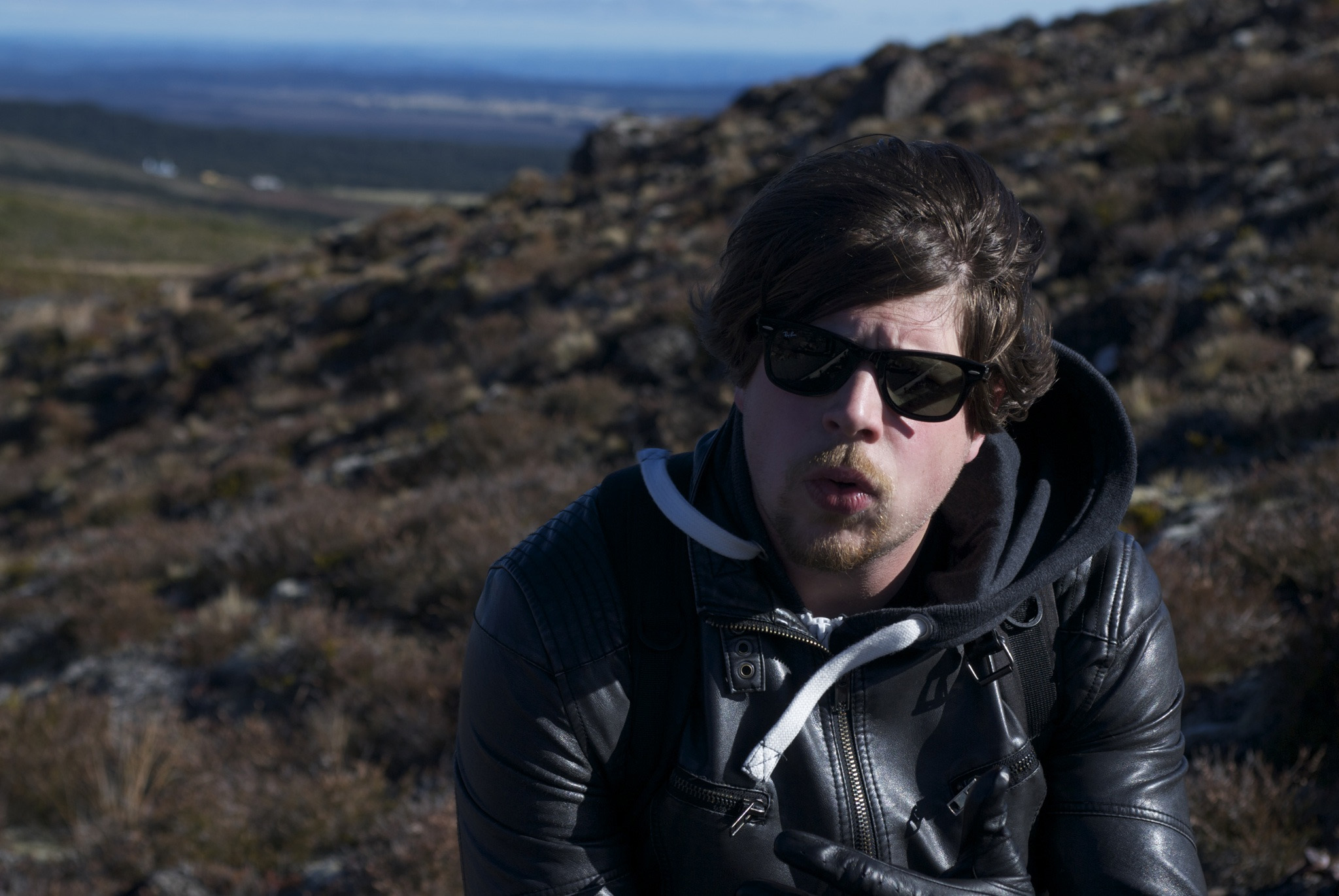 In early May me and my flat mate Hans finally spotted a sunny weekend in what would otherwise be a depressing and rainy autumn. We haven’t been out of the city for way to long and we are in need of a break. We found it!
Friday after work we leave Auckland early in the evening and head for Taupo. A quiet three hour drive into the darkness. When we get to Base Backpackers we drop our stuff in our dorm and set out for some well deserved friday night drinks! In the summer Taupo is the true adrenaline city of the north island, and in the winter it turns into a lively alpine town. But right now it feels deserted. A few places try to attract us with loud music, but only one bar seems to have actual people in it. A few drinks later we head back for a good night of sleep.
We get up early. We still have a hour of driving ahead of us so we get back on the road first thing, only to find out that getting up early wasn’t early enough. At the DOC info centre they tell us that starting at 9.30am is cutting it close for this 6-8 hour walk, so they advice us to wait for the next day. This bums us out but considering the crossing is already outside of our comfort zone we don’t want to push our luck even further by ignoring some experienced advice. We opt to change our plans, do the crossing tomorrow, and walk a different suggested track today.
We don’t take long getting ready for our 19km loop track to the Tama lakes. The start is just around the corner of the DOC info centre in Whakapapa, so we leave the car in the car park and get on it.

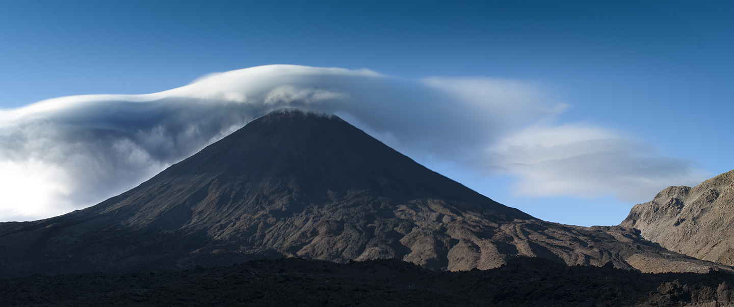
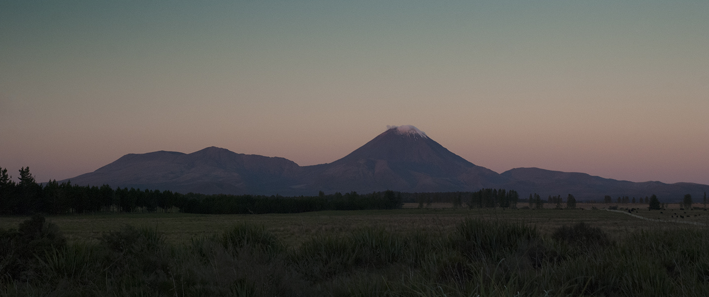
The track starts nice and smooth. It gets a little bit more hilly 30 minutes in, with some tiring upward walks. But the view of the grasslands and the great Mount Doom on the horizon keeps the mood up. The wind on the other hand is strong and cold, burning our faces and freezing our hands. We mostly keep to ourselves, walking on our own pace. Catching up with each other once in a while. The track was well maintained, and easy to follow and after about 1,5 hours we were staring down at the lower Tama lake. We weren’t to impressed, so we continued up to the upper Tama lake, which had no defined path. Instead we simply had to follow some guiding sticks.
The final climb to the rocky ridge was steep and long. Together with the strong cold wind it was a real challenge. We had to stop every few meters to catch our breath. But the 30 minutes of heavy climbing was well worth it once we reached the top and enjoyed the beautiful view. The way down was a real treat compared to the way up, but heavy on the knees. On the way back we passed a little waterfall as a nice extra before reaching the end of the track and heading back to our car.
The Crossing
The next day we woke up even earlier. Today is the day! We stayed at a backpackers in National Park not very far from the start of the alpine crossing. Surprisingly the hostel was fully booked. Last night we opted to book a shuttle from and back to the backpackers. At 7:15am it was busy with people getting ready for a long day of torture.
30 minutes later we arrive at the drop off and it was time to face the music. We were part of the eager ones, to get ahead of the majority and energised to get the easy part behind us. Quickly the steady stream of walkers started to disperse into smaller and smaller groups.
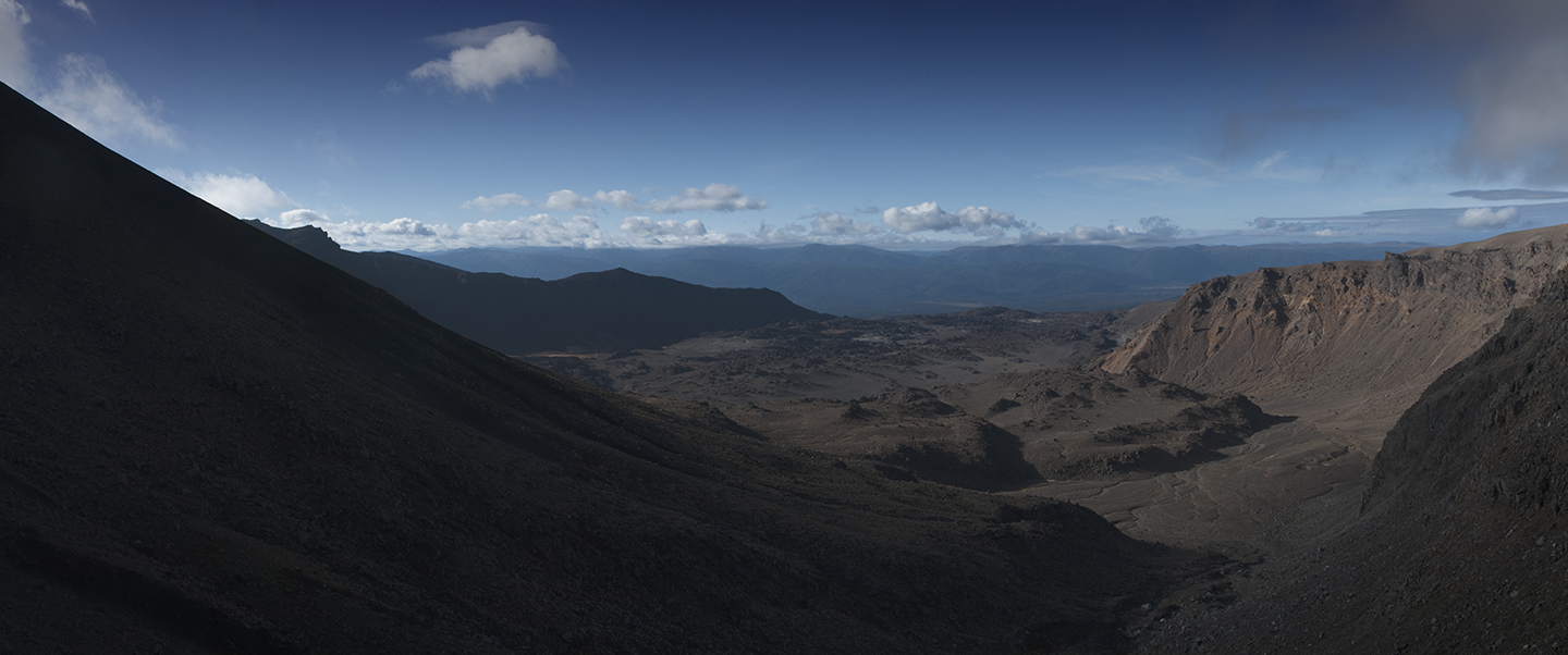
We had been warned and it was pretty clear when we reached it; the Devils Staircase. If it sounds angry its because it is! The longest and steepest climb of crossing. 40 solid minutes of continuous ascent. Even though the DOC had been kind enough to turn the steepest parts into steps it didn’t took away the beating our legs had to endure. The good thing is that during the many breaks you’ll need to take you can enjoy the absolutely stunning scenery. With clear vision you can see incredibly far.
From the top of The Devils Staircase to the south crater (one of the many old eruption craters) was a plateau. A welcomed relieve to our now chronically burning legs. But it didn’t last long. The second challenge, the ascent to the ridge of the red crater, proved to be a real pain in the ass. Every time when you think you had reached the top it would take a turn and go up even more. By now we were completely exposed to the wind, and it would almost blow you of your feet. I imagined people being blown of the ridge on the really bad days. Doing this on my All Stars wasn’t helping either. But boy, those views were so worth it.
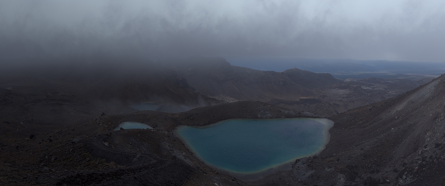
Once on the ridge of the red crater it was mostly down hill. The emerald lakes made for a pretty picture with yet another great vista of the north island. I could run my way down from the ridge, sliding through the lose volcanic sand. The closer I got to the emerald lakes the more I got to enjoy the strong smell of sulfer. Who doesn’t like the smell of rotten eggs?
The next hour or so was fairly straight forward. Mostly downhill. By now we were basically alone on the mountain. We left most people behind us, and the real die hards were probably already back at the backpackers.
The last treat of the walk was catching a glimpse of the Te Maari volcanic hazard zone that erupted just months ago and was still furiously smoking. Preparing himself for its next violent tantrum. You can’t get really close but it still looks impressive. The smashed roof of the Ketetahi hut is a good reminder of the dangers of even a small eruption like the last one.
From the hut it is a steady 1,5 hour walk back to the Ketetahi car park. The last part is through some dense rain forest but by then we are walking in our t-shirts, embracing the hot and burning sun. At the finish we join all the other, by now, familiar faces and wait another two hours before we get picked up.
I have a good laugh with fellow Dutch guy and his British mate. They’d climbed the Mt Ngauruhou (Mt Doom), which was way to hard for our untrained bodies to accomplish today, but its on my list for the next time!
Factsheet:
– We paid NZ$35 a day for our car over at http://www.acerentals.co.nz
– We spend NZ$30 on both Base Backpackers in Taupo and National Park Backpackers in National Park a night.
– We paid NZ$35 p.p. to be picked up, and dropped off from our hostel to the start of the track.
– Use http://www.metservice.com for the weather forecast.
– Get all the latest information on the official DOC page: http://www.doc.govt.nz/parks-and-recreation/tracks-and-walks/central-north-island/ruapehu/tongariro-alpine-crossing/
Erwin
What a great story! Mount Doom is ready to get you.
edith
geweldig om weer iets van jou te lezen, ook al is het door de vertaalmachine lachwekkend.
Geniet lekker daar. Ook al missen de jongens jou hier wel heel erg.
Ik wacht op de volgende mooie verslagen en de foto’s.
groetjes van mij xxx edith ( moeder tamara)